IGNrando' – France hiking maps 1.49
Free Version
Publisher Description
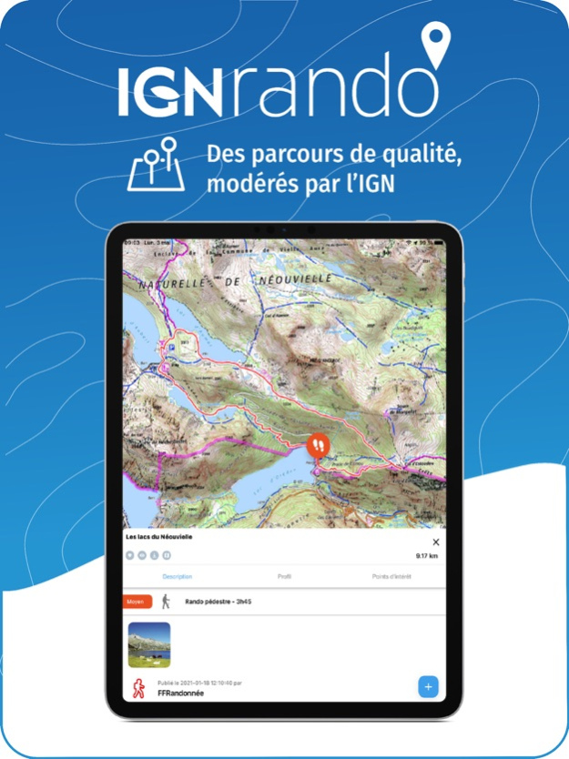
IGNrando' is the National Geographical Institute's official app for outdoor activities in France. Find thousands of routes & never get lost with the best available maps.
IGNrando’ is a French collaborative platform offering curated data and services related to outdoor activities.
RICH DATA OFFER
• Tens of thousands of available routes accross Metropolitan and Overseas France
• Choose the activity, difficulty and length to find routes around you or near any other place
• Download or mark as favorite the desired routes or POIs
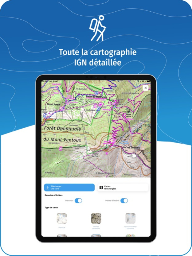
MAPS & LAYERS IN FREE ACCESS (with internet connection)
• Plan IGN: most updated map, suitable for all activities
• Aerial photos (IGN)
• OpenStreetMap Outdoors: world map with hiking routes & contour lines
• OpenCycleMap: world map with cycling routes & contour lines
∙ Spain IGN map
∙ Swisstopo map
∙ Emergency calls (112) mobile network coverage map for France
∙ OpenSnowMap
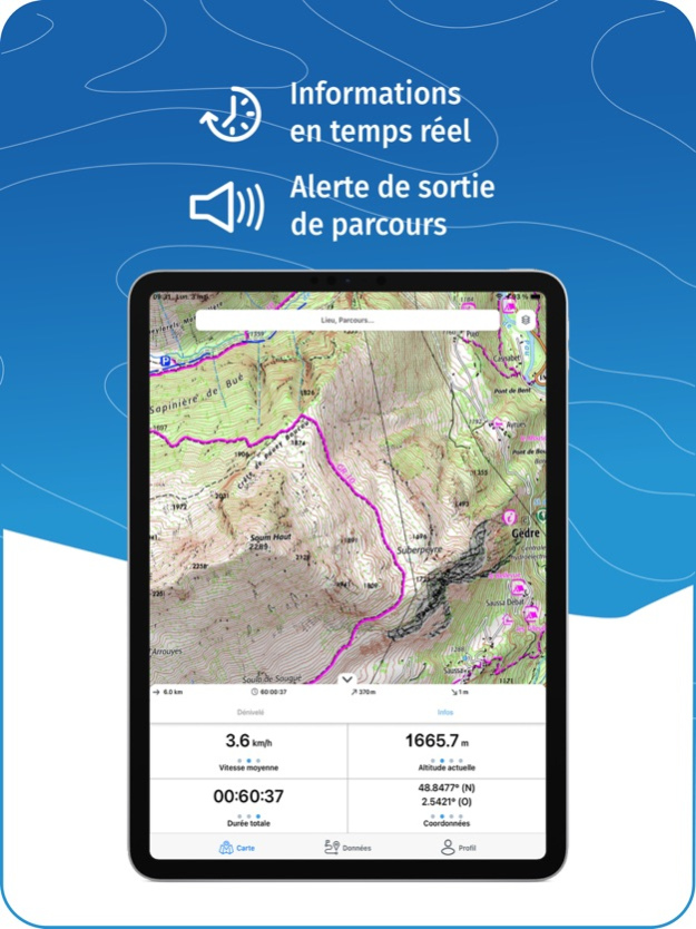
GPS GUIDING ALONG ROUTES
• See your progression on the map and on the elevation profile
• Get alerted if you exit the route
• Get notified of upcoming POIs or route info points (available soon)
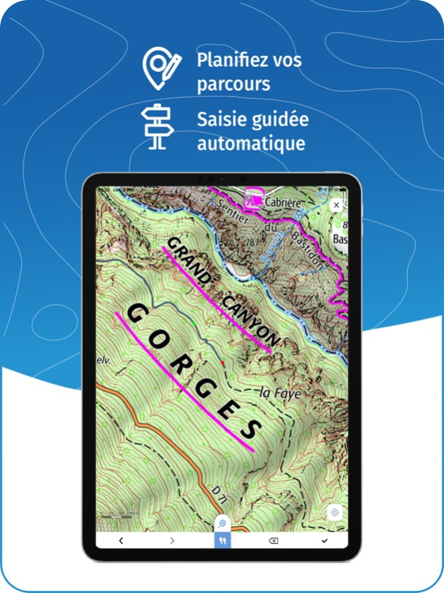
GPS TRACKING AND DATA CREATION
• Record your own routes using GPS
• Quickly create routes on-device with the automatic routing tool that follows roads and paths (online only, with subscription)
• Create Points of interest
• Export Routes or Points to save them locally (Files app) or share them
• Send your routes to ignrando.fr for backup or to publish them
OFFLINE USE
• The GPS keeps working even without internet: see your position on the map, use GPS guiding and record routes
• Downloaded routes: descriptions, photos and guiding remain accessible
• Downloaded maps (with subscription)
USEFUL TIP: Enabling Airplane Mode or disabling Mobile Data improves battery life, without affecting the Location Services (GPS)
IGN MAPS SUBSCRIPTION
• Create routes with pedestrian and vehicle routing
• View & download the following maps & layers:
∙ All free version maps
∙ IGN maps (various scales)
∙ IGN 1:25k topo maps (Top 25): the famous French topographical maps available at all zoom levels
∙ 1950 IGN maps
∙ Military maps (1820-1866)
∙ ICAO aeronautical charts
∙ France mobile network operators coverage maps
∙ Cadastral parcels layer
∙ DFCI grid (forest fire protection grid)
• Drones flight restriction areas
∙ Roads & paths layer (only available with Aerial photos)
IGNrando' store subscription
• Linked to IGNrando' account
• No automatic renewal
• Can be used on 3 devices at the same time
App Store subscription
• Linked to Apple account
• Automatic renewal unless cancelled at least 24 hours before the end of the current period
• Auto-renewal may be turned off by going to the user's Account Settings after purchase
• Any unused portion of a free trial period will be forfeited when the user purchases a subscription
WARNING: Ubicarta or IGN cannot refund subscriptions purchased on the App Store, only Apple can, at its sole discretion
ONLINE HELP (french only)
https://ignrando.ubicarta.com/help
FAQ (frequently asked questions - french only)
https://ignrando.ubicarta.com/faq
TERMS OF SERVICE
https://ignrando.ubicarta.com/terms
PRIVACY POLICY
https://ignrando.ubicarta.com/privacy
Apr 7, 2024
Version 1.49
• France mobile network operators coverage maps overlay
About IGNrando' – France hiking maps
IGNrando' – France hiking maps is a free app for iOS published in the Recreation list of apps, part of Home & Hobby.
The company that develops IGNrando' – France hiking maps is Ubicarta. The latest version released by its developer is 1.49.
To install IGNrando' – France hiking maps on your iOS device, just click the green Continue To App button above to start the installation process. The app is listed on our website since 2024-04-07 and was downloaded 8 times. We have already checked if the download link is safe, however for your own protection we recommend that you scan the downloaded app with your antivirus. Your antivirus may detect the IGNrando' – France hiking maps as malware if the download link is broken.
How to install IGNrando' – France hiking maps on your iOS device:
- Click on the Continue To App button on our website. This will redirect you to the App Store.
- Once the IGNrando' – France hiking maps is shown in the iTunes listing of your iOS device, you can start its download and installation. Tap on the GET button to the right of the app to start downloading it.
- If you are not logged-in the iOS appstore app, you'll be prompted for your your Apple ID and/or password.
- After IGNrando' – France hiking maps is downloaded, you'll see an INSTALL button to the right. Tap on it to start the actual installation of the iOS app.
- Once installation is finished you can tap on the OPEN button to start it. Its icon will also be added to your device home screen.
